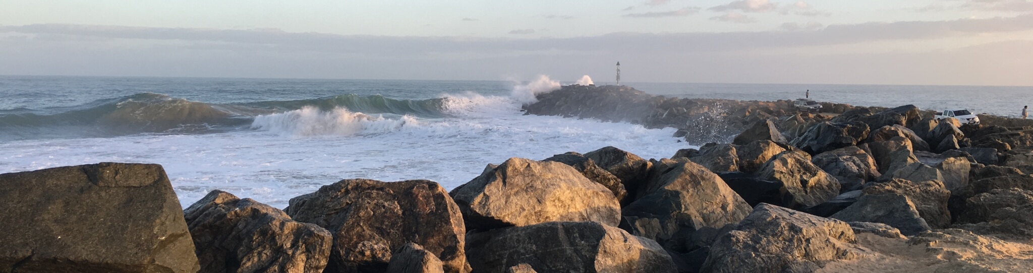
The coastal zone has great environmental, social and economic significance and value to Australia. It is where most Australians live and work and it is the main avenue for our export economy. Extensive ecosystems of global and national significance are in the PNP coastal zone with Ramsar listed wetlands and the diversity of marine plants and animals in southern Australia is among the highest in the temperate regions of the world with the south-west of Western Australia being recognised as an international biodiversity hotspot.
The Peron Naturaliste region has been identified as vulnerable to the impacts of coastal climate change in the Australian Government’s First Pass National Assessment [i]. The region has low lying sandy coastal and shallow estuarine environments and has high residential, commercial, recreational and ecological significance.
For more information on the coastal environment of the Peron Naturaliste region go to the Region page.
[i] Department of Climate Change. (2009) Climate change risks to Australia’s coast: a first pass national assessment. Australia Government, Canberra
Coastal hazards can result in property damage, loss of life and / or environmental degradation. The impacts are generally greatest where the shoreline has been modified and developed for infrastructure or settlements. The most significant hazards include:
Hazard mapping of the Peron Naturaliste region was undertaken as part of the PNP Project Developing Flexible Adaptation Pathways for the Peron Naturaliste Region of Western Australia [ii].
[i] Damara WA. (2016) Shire of Harvey Coastal Hazard Risk Management and Adaptation Plan. Prepared for Shire of Harvey. Report 246-00-09
[ii] Damara WA. (2012) Coastal Hazard Mapping for Economic Analysis of Climate Change Adaptation in the Peron-Naturaliste Region. Report 169-01
The Australian Governments First Pass National Assessment noted that the climate system is changing faster than projected and that the impacts of climate change are likely to be more severe. There are numerous and significant potential coastal impacts and risks associated with climate change, such as:
These impacts and risks will affect the Peron Naturaliste region’s natural and built environments and may have further consequences on the community, which could include; temporary coastal flooding, permanent marine inundation, increased heat related health issues, changes in mosquito activity and subsequent impact on residents and economic impacts on those industries which rely on our waterways and coast, such as tourism and accommodation businesses and commercial fishing.
The PNP Project Developing Flexible Adaptation Pathways for the Peron Naturaliste Region of Western Australia [iii] includes a synthesis report of coastal hazards affecting the region and an economic analysis of potential affected areas. The summary of the results show from now to 2100:
Some member Local Governments in the Peron Naturaliste Region are in the process of identifying local impacts and risks and developing actions to minimise these risks. For example, the Shire of Harvey has recently developed a local-scale Coastal Hazard Risk Management and Adaptation Plan (CHRMAP) and the City of Mandurah has a Coastal Zone Climate Change Risk Assessment and Adaptation Plan.
[i] Department of Climate Change. (2009) Climate change risks to Australia’s coast: a first pass national assessment. Australia Government, Canberra
[ii] CoastAdapt. (2016) National Climate Change Adaptation Research Facility. https://coastadapt.com.au/overview-likely-climate-change-impacts-coast. Accessed 1 December 2016
[iii] Acil-Tasman Pty Ltd. (2012) Climate Change Adaptation Options Assessment – Developing Flexible Adaptation Pathways for the Peron-Naturaliste Coastal Region of Western Australia. Prepared for Peron-Naturaliste Partnership
It is acknowledged by the scientific and general community that climate change impacts are currently taking place in the coastal zone. In addition to reducing our emissions (mitigation) we need to take measures to adapt to the impacts and reduce the risks of climate change that are occurring now and will do so into the future.
Important factors to consider in better planning and managing the coast inlcude:
The PNP is working with government, coastal communities and interest groups to look at adaptation decision-making pathways to best balance competing economic interests with social values, ecosystem services and environmental benefit. By taking adaptive measures we can develop a more resilient community that can better deal with current and future risks associated with coastal climate change. For the PNP our focus is to:
To see all the projects that the PNP have completed or are currently undertaking go to Projects.
CoastAdapt is an online coastal climate risk management framework developed by the National Climate Change Adaptation Research Facility (NCCARF) to support adaptation to coastal climate change and sea-level rise. NCCARF have released a beta trial version so that potential users may provide feedback on its usefulness.
The Western Australian Department of Planning Coastal Planning Policy 2.6 provides for the long term sustainability of Western Australia’s coast.
The Western Australian Department of Transport has information regarding sea level and sedimentation studies that help stakeholders including the community understand how erosion affects the stability of the Western Australian coast.